News Summary
San Antonio and Austin are bracing for much-needed rain this week, with forecasts predicting 1 to 3 inches. This comes as both cities face worsening drought conditions affecting the Edwards Aquifer. A significant weather pattern shift is expected to bring moisture, potentially alleviating the exceptional drought status in the region. Residents should prepare for possible flash flooding as rainfall totals may exceed 3 inches in some areas.
San Antonio and Austin Brace for Much-Needed Rain This Week
Hey there, folks! If you’re in San Antonio or Austin, grab your umbrellas and rain boots because this week looks like it’s finally bringing some wet weather your way. The Weather Prediction Center is forecasting rainfall totals between 1 to 3 inches across the region—a welcome sight for many suffering under deepening drought conditions.
Current Drought Alert
What’s the story? Well, San Antonio has been feeling the heat, and not just from the rising temperatures! The city is grappling with a drought that has worsened due to the unseasonably dry and warm weather lately. In fact, the current levels of the Edwards Aquifer are more than 40 feet below what we would normally see in March, causing record low lake levels and weak river flows. Talk about a rough stretch for our water sources!
A Big Change on the Horizon
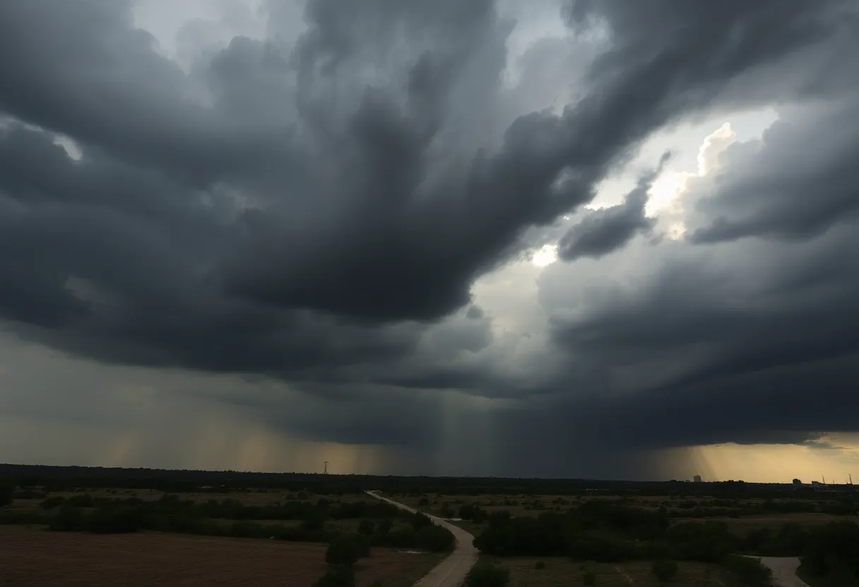
However, it looks like a significant weather pattern shift is finally arriving this week, bringing a much-needed dose of moisture to drought-stricken South Texas. Monday morning also kicked off with some scattered storms just north of San Antonio. By the afternoon, expect the sun to peek through once again!
Highs and Lows
For Monday itself, temperatures might hit around 90 degrees, but good news—northeasterly winds up to 10 mph will provide a bit of a breather from humidity, making it feel a little more bearable. Tuesday looks quite similar, maybe even a degree or two warmer. However, brace yourselves! After sunset on Tuesday, cloud cover will increase, setting the stage for some rain midweek.
Rain Arrives Midweek
Wednesday rolls around and should stay dry for most of the morning. But as the day progresses, you can expect shower chances to ramp up, particularly near and south of Interstate 10. Meanwhile, keep an eye on those developing storm clouds towards the west of San Antonio—that’s where the action is likely to kick off Wednesday night!
Thursday: When the Storms Hit
Now, Thursday is where it gets interesting. Various forecast models are a bit at odds with one another. The American GFS model suggests we might see some heavier rain by Thursday evening, while the European model hints that San Antonio might not see much action until later in the afternoon. Either way, with rainfall totals possibly exceeding 3 inches in some areas, especially west of I-35, it’s wise to prepare for potential flash flooding. According to the Weather Prediction Center, we’re looking at a level 1 risk out of 4 for flash floods on Thursday.
Be Prepared for Flooding
It’s important to keep in mind that while we’re not anticipating severe storms, minor flooding is a real possibility. The dry soil may struggle to soak up the heavy rain expected, so keep your eyes peeled if you’re out and about!
Why Now?
So why is all this rain about to pour down? A major storm system currently hovering over the lower Mississippi River Valley is influencing the weather patterns across the area. Plus, with the recent increase in moisture and calmer winds forecast for the weekend, the risk of wildfires—which had been a growing concern—is expected to drop. It looks like those atmospheric disturbances are going to engage with moist Gulf air to bring the rain we desperately need.
A Ray of Hope
As per the latest U.S. Drought Monitor report, parts of San Antonio and Bexar County are classified as being in an exceptional drought, which is the worst category on the scale. This makes the upcoming rainfall all the more critical. After weeks of dry spell, the arrival of rain could finally offer a little hope to our parched landscape. Let’s hope it delivers!
So stay tuned, everyone! The coming days might just wash away a bit of that dryness we’ve been dealing with.
Deeper Dive: News & Info About This Topic
HERE Resources
Severe Storms Cause Havoc in San Antonio and Hill Country
San Antonio Faces Severe Drought as Rain Forecasts Fall Short
Severe Thunderstorms Bring Rain and Hail to San Antonio
San Antonio Faces Extreme Drought, Rain Chances Improve
Canyon Lake’s Water Levels Plummet to 50-Year Low
House Fire Erupts in Northeast San Antonio Amid High Winds
Chilly Mornings and Dusty Skies Hit San Antonio
San Antonio Residents Experience Hazy Skies from West Texas Dust
San Antonio Faces Elevated Fire Danger This Week
Exceptional Drought Devastates South Texas
Additional Resources
- Express News: Drought Relief This Week
- Wikipedia: Drought
- News 4 San Antonio: Weather Shift
- Google Search: San Antonio Weather
- Weather.com: San Antonio Weather
- Google Scholar: Weather Pattern Shift
- KSAT: Hail and Thunderstorms
- Encyclopedia Britannica: Weather Forecasting
- Express News: Sunday Rain Chances
- Google News: South Texas Weather