
The Tri-State area experiences severe weather as winter storms create hazardous conditions.
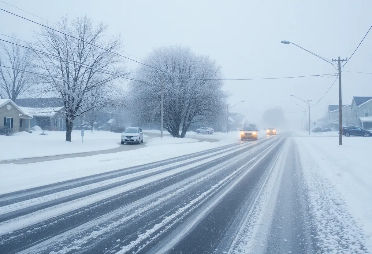
The Tri-State Area is grappling with its fourth winter storm in one week, prompting significant weather warnings across New York, New Jersey, and Connecticut. Residents can expect hazardous conditions, including icing and damaging wind gusts. Airports are experiencing notable disruptions with hundreds of cancellations and delays. As temperatures remain below freezing this week, another winter storm may be on the horizon. The impact on travel and daily life has been significant, urging residents to stay alert and prepared for ongoing winter challenges.
Oh boy, the Tri-State Area has certainly been feeling the *chill* lately! After an unexpected winter storm rolled in on Saturday, residents were met with their **fourth winter storm in just one week**. That’s right, this season has been all about snowflakes and chilly winds, and it’s not done with us yet.
To put it simply, Sunday was officially declared a **First Alert Weather Day**. Why, you ask? Well, **significant icing**, heavy rainfall, and **potentially damaging wind gusts** across New York, New Jersey, and Connecticut posed a real threat. Residents were advised to batten down the hatches as rain was expected to finally say goodbye by 8 p.m. But don’t let your guard down just yet; embrace yourselves for *strong winds* that would follow.
The situation in New Jersey specifically was pretty serious, with a **high wind warning** in effect until Monday evening. Other nearby areas were under a **wind advisory**, all of which had folks on high alert. Unfortunately, Monday was also marked as a **First Alert Weather Day** because the strong winds had every chance of causing damage. With wind gusts reaching between **40 to 60 mph**, be prepared for the possibility of downed trees and power outages.
Things got sticky—literally—when it came to freezing rain! The northwest suburbs, particularly **Sullivan and Ulster counties**, faced major icing concerns. Certain valley locations, known for trapping cold air, were at higher risk. Weather models suggested that **ice accretion** could potentially reach between **0.25 to 0.5 inches**, especially near weakened trees due to ongoing drought conditions. This means some trees might not hold up against the harsh weather, making the potential for downed power lines a real worry.
If you had plans to fly, over at the airports, it was quite the chaotic scene. John F. Kennedy International Airport had to report a staggering **117 cancellations and 498 delays**. LaGuardia Airport fared similarly with **223 cancellations and 417 delays**, and even Newark Liberty International Airport wasn’t spared, tallying up **142 cancellations and 448 delays**. So, if you had friends or family trying to catch a flight, it’s safe to say they likely hit a snag!
As far as snow is concerned, accumulations varied greatly across the region. The northwestern Tri-State Area saw up to **4.5 inches** of snow, with West Shokan in Ulster County topping the charts there. Meanwhile, Central Park barely got in on the action with just **0.5 inches**. In West Orange, New Jersey, folks measured about **2 inches**, and Lake Mohawk saw less than an inch. Connecticut’s New Fairfield came in with **2.6 inches**, while Bridgeport managed **1.5 inches**. Quite the mixed bag of snow amounts!
As if this week hasn’t been wild enough, there’s talk of yet another winter storm potentially brewing for Wednesday into Thursday. What can we expect? Well, the exact details are still a bit fuzzy, but there’s a chance for **accumulations of over 6 inches of snow**. On the other hand, some forecasts suggest we might dodge a significant impact altogether. Stay tuned, because it’s a bit of a weather rollercoaster ride right now!
To wrap things up, it looks like this icy spell isn’t letting go just yet. After the storm passes, be ready for those **colder temperatures** to stick around, with highs staying below freezing for most of the week. So dig out those fuzzy hats and mittens because winter isn’t finished with the Tri-State Area just yet!
News Summary Texas retailers are gearing up for challenging times as a recent survey reveals…
News Summary Pape-Dawson, a Texas-based engineering firm, has acquired Morris Engineering & Consulting LLC in…
News Summary The construction industry in Texas is facing significant challenges due to rising costs…
News Summary In Houston, local businessman Kent Edwards is taking legal action against the Texas…
News Summary Sempra, the energy services company, is making significant moves in Texas by divesting…
News Summary Texas announces a landmark $10 billion property tax relief deal aimed at reducing…